Wyoming (Spearfish Canyon and Devils Tower) [240518-19]
Wyoming didn't originally make the "East of the Rockies" cut for this Trek, since the Rockies go through Wyoming and we've already visited the two national parks there. But when we discovered how close Devils Tower was to the Badlands, we couldn't resist making a small foray in Wyoming to visit it while in the area, since neither of us had seen it before. On the way, we made a point of driving through Spearfish Canyon - on the recommendation of the camp host we had met in Johnson's Shut-ins State Park back in April.

-----
The Wall Drug dinosaur bid us a fond "farewell" Saturday morning as we hopped on I-90 and headed east, leaving the Badlands NP area for good.


Another 90 miles west/north brought us to the city of Spearfish, which happened to have one of the first Safeway grocery stores we'd seen in weeks. We had added a number of Safeway for U offer items to our account that morning, and were somewhat surprised to see them all disappear from our account when we signed into their WiFi. We composed a new shopping list from the new set of (apparently regional) Safeway for U offers presented and finished our restocking run.
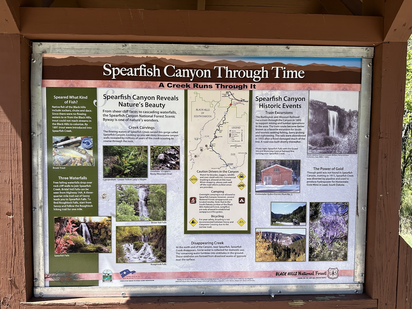
We didn't know much about Spearfish Canyon, so we found this interpretive sign at the "start of the road" helpful.


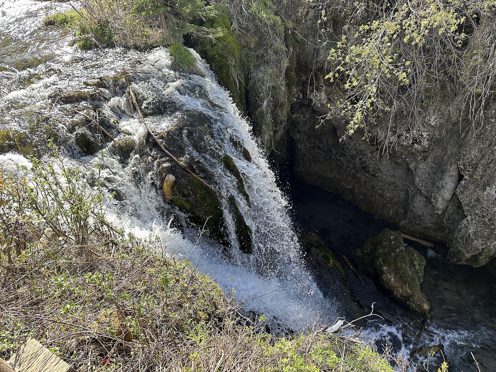
We were confused by a roadside parking lot that was marked "Devil's Bathtub", because there was no such thing marked on the map seen above. There seemed to be a makeshift path leading off from it, which we walked for a little ways, but it just kept going and going. We finally returned to the T42 and fired up the WeBoost, getting enough signal to do a very slow Google search that revealed the hike would take at least an hour and "Throughout the hike you will have to cross the stream several times, most likely. Often times trees and rocks provide makeshift bridges that you can attempt to cross on." - which we took to mean it was pretty much guaranteed that you'd get your feet wet at one point or another. We decided to pass, settling for this photo of a little dam by the parking lot instead.

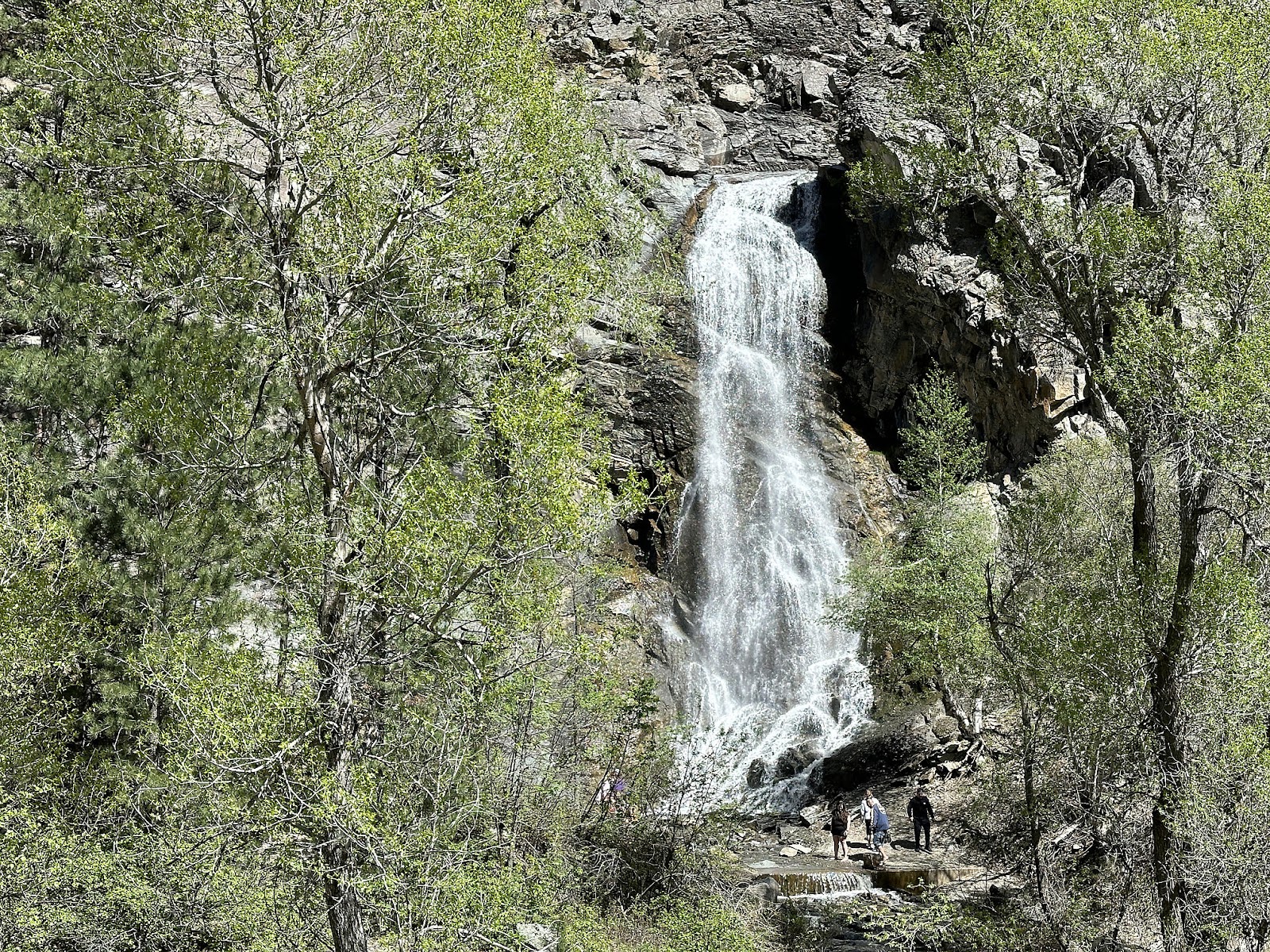
The signage in the Spearfish Falls / Roughlock Falls area was somewhat confusing. We parked in the lot by this sign here, but the hike from the Upper Spearfish Falls Observation Deck...


Guessing that all the trail lengths on the sign might be overestimated, we decided to just hike up to Roughlock Falls from our current parking spot rather than drive up to one of the lots further up the narrow gravel road. It turns out our guess was wrong, and we're not exactly sure where they were measuring the "1 mile" from. But the combined hike ended up being 3.2 miles, with an elevation gain of 270 feet.


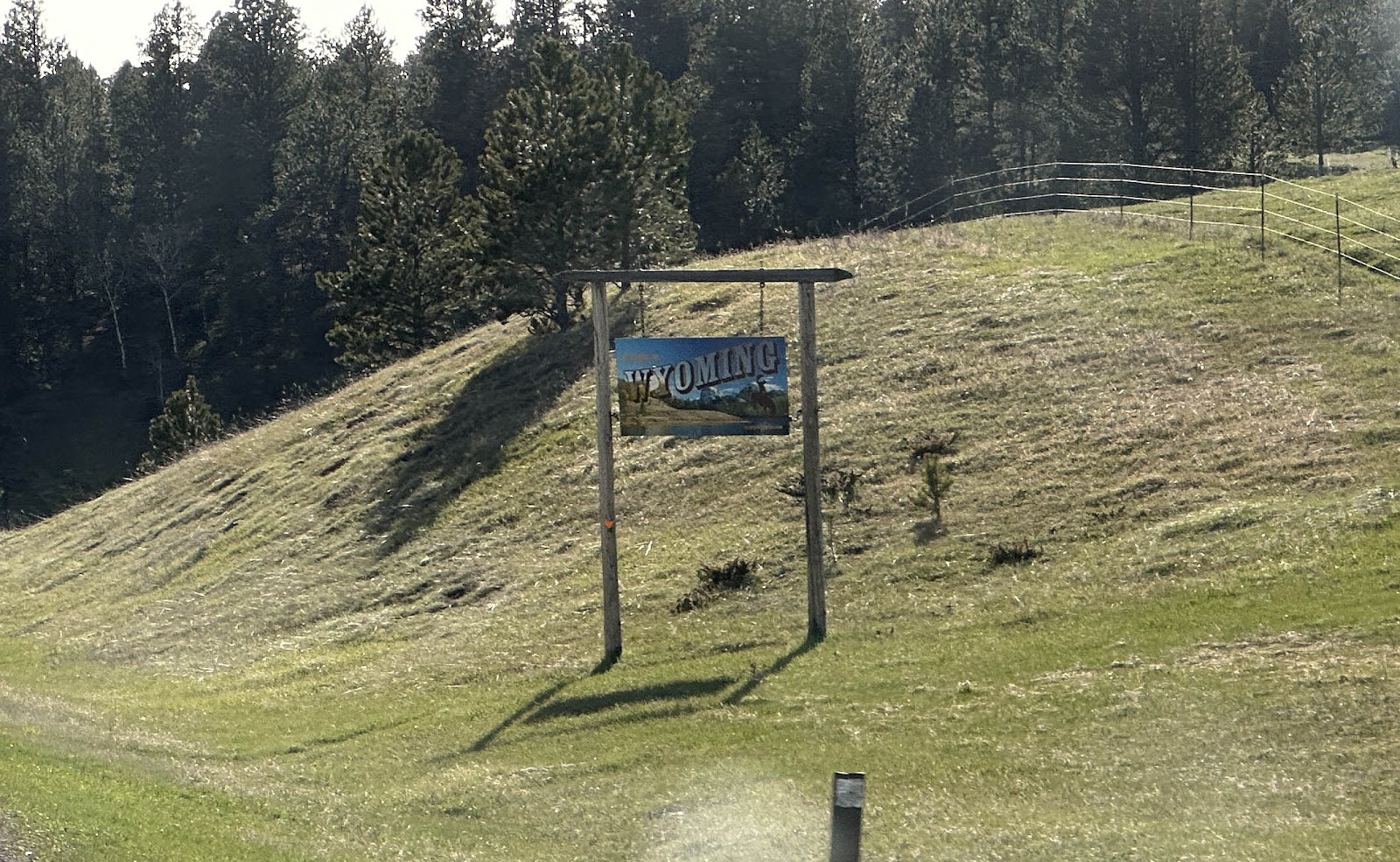
Leaving Spearfish Canyon behind, we crossed over into Wyoming at 6:21.
We pulled into the little town of Sundance around 7 p.m., where we'd be overnighting in the parking lot of the Travel Center (photo actually taken at 6:30 a.m. the next morning).


-----
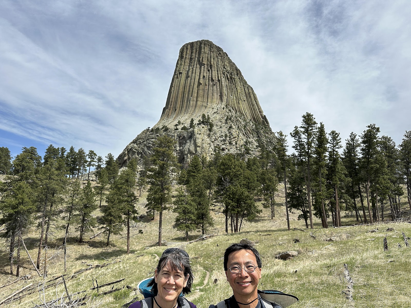
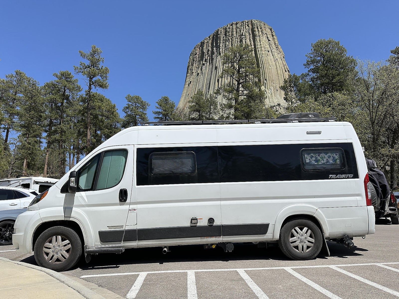
Sunday morning, we filled up gas at the Travel Center, did a dump/fill at the Rest Area across the freeway, and were back on the road headed towards Devils Tower by 8 a.m. We got our first glimpse of the Tower in the distance about a half hour later.


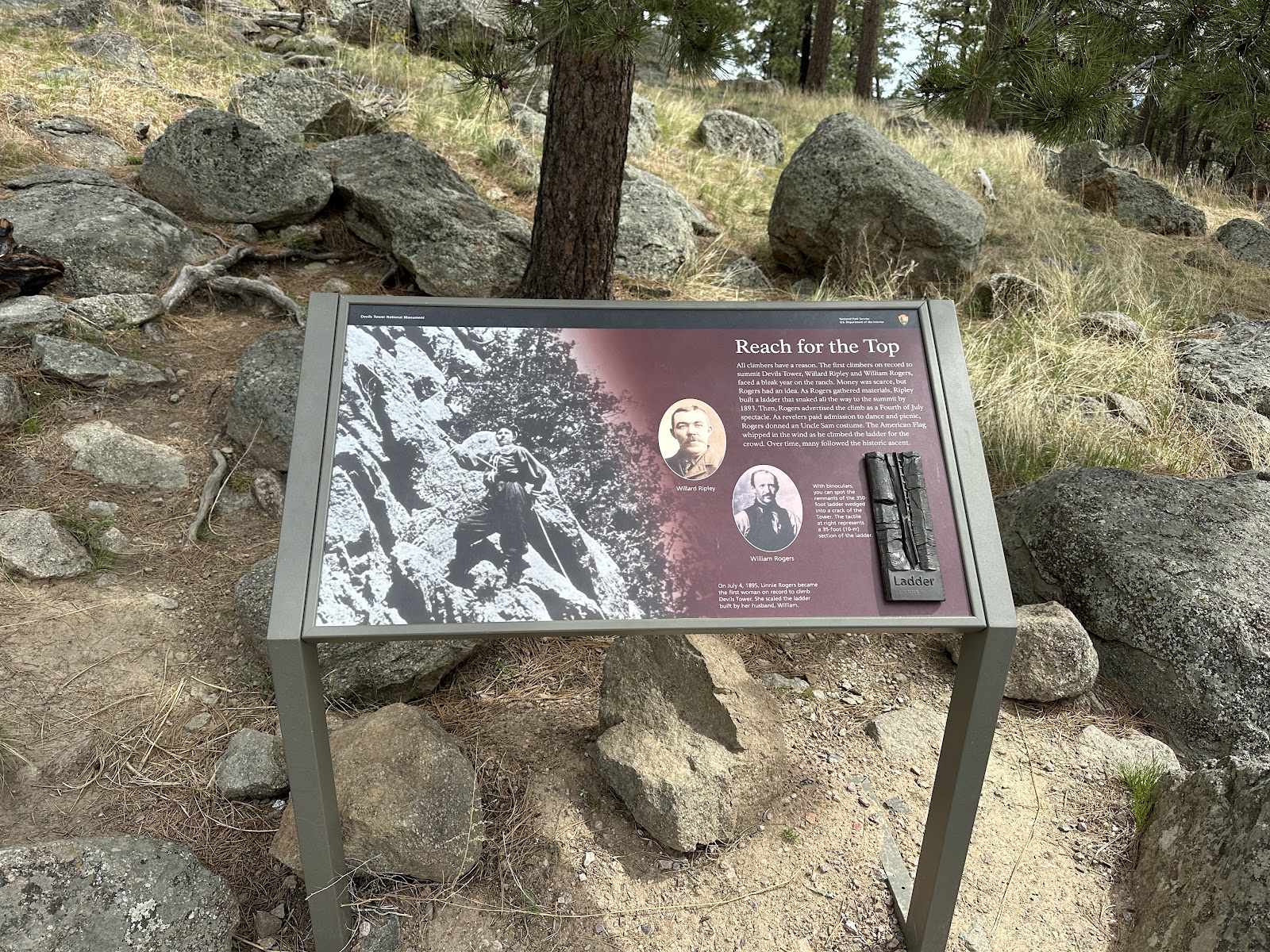
There are two main trails at Devils Tower, and we decided to hike both - starting with Tower Trail, which is a 1.5 mile paved trail that circles fairly close around the Tower. It never occurred to us before that the Tower isn't symmetrical, and changes its shape depending on what side you're looking at it from.


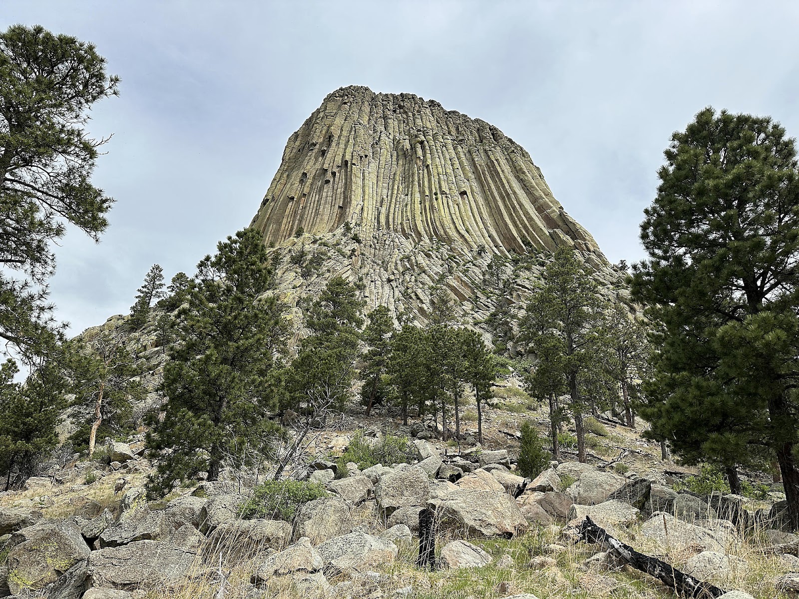


The Red Beds Trail does a much wider 2.8 mile loop around the tower. It's unpaved with a fair amount of elevation change (450 feet total, as measured by Apple) so the Tower isn't even visible from large portions of the trail.


On the way out, we stopped by the prairie dog field. But it appeared to be lunch time in Prairie Dogland: a lot of eating, and not a lot of cuteness going on.


That night we stayed at the Gascoyne Lake Campground, a free campground just outside of Scranton, ND (read as "out in the middle of nowhere"). It was an extremely windy night and we had the entire campground to ourselves (except for a couple of prairie dogs hiding in the lawn). As we climbed into bed that night, we hoped that Scranton had no ax murderers...


Comments
Post a Comment