Sylvan Lake, in the northwest corner of the park, served as our parking place for two days' worth of adventures. The Needles Highway was our adventurous way of getting there.
-----
Thursday's weather didn't look promising for a long hike either, so we decided to head up to Sylvan Lake - by way of the infamous Needles Highway. Our park map showed that the clearance in the shortest tunnel was going to be 9' 9". A stock Travato is 9' 9" tall, but the extra cargo on our after-market roof basket makes the T42 just shy of 10' driving down the road these days - so Tom spent a half hour in the morning moving items down from the roof into the van so that we'd be sure not to scrape anything (well, not the ceiling anyway).
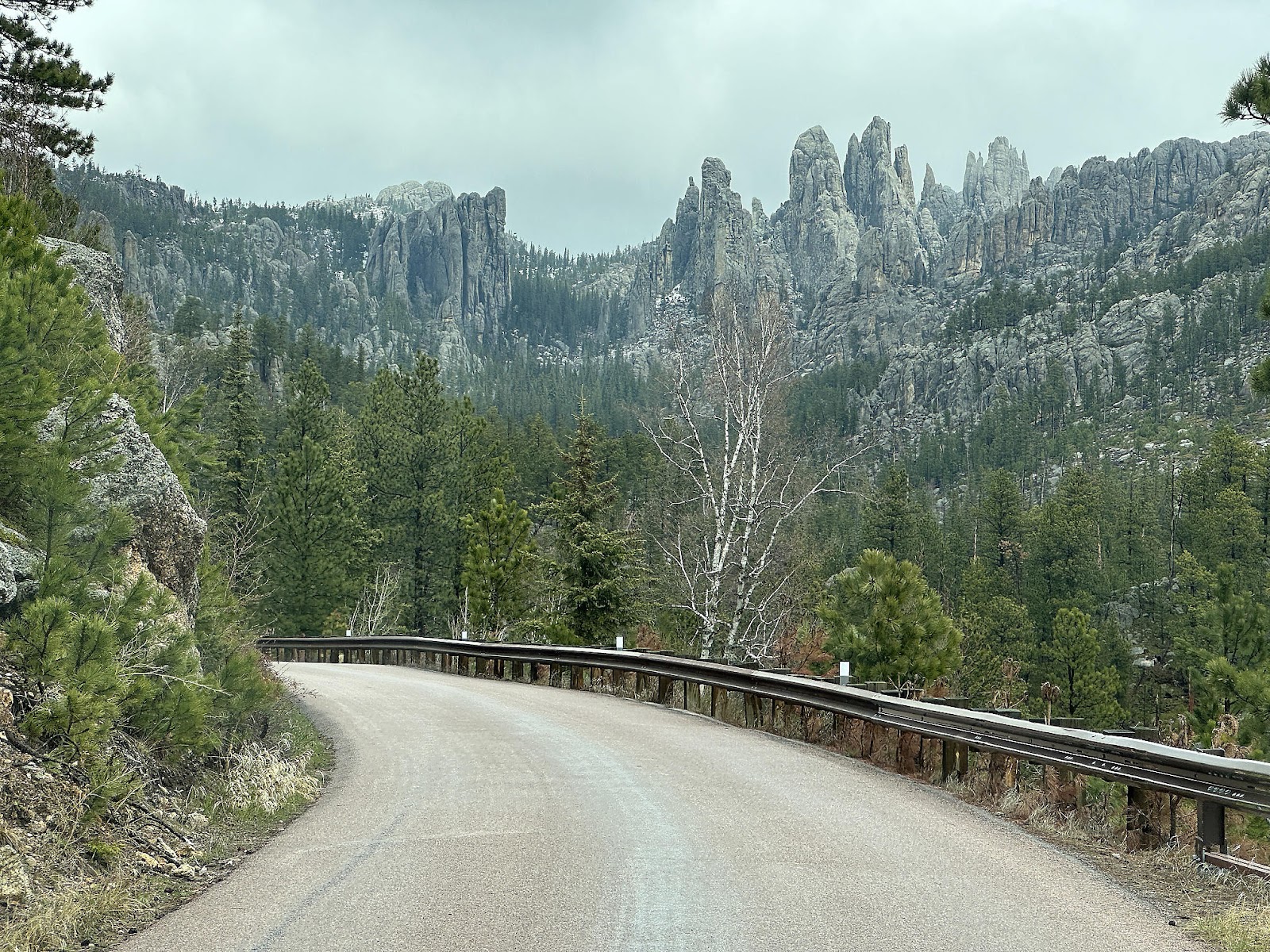
The Needles Highway started out like any other country highway, but then started looking a bit like Highway 120 in Yosemite between the entrance station and the Foresta turnoff: very hilly with lots of fun tight curves. Some portions were narrow enough that they didn't put center striping on the road.
We made it through Iron Creek Tunnel, the first and wider of the two, unscathed so we felt confident proceeding onward.
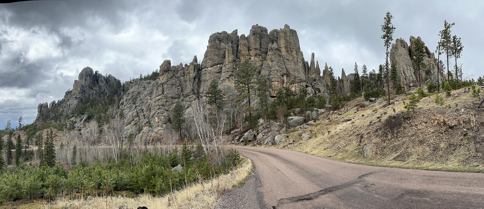
As we drove higher up the mountain, we were rewarded with our first "real" views of the Needles rock formations.
At the Cathedral Spires Trailhead parking area (which literally is a small handful of parking spots arranged around one of the hairpin turns in the road) we briefly debated whether we should just do the Cathedral Spires Trailhead that day instead since the parking area was so small and we accidentally managed to get a spot in it (just wanting a place to stop and take photos), but anticipation of driving through the infamous Needles Eye Tunnel (just a short ways further up the road) won out and we continued upward.
Driving the Needles Eye Tunnel for the first time - particularly in something the size of the T42 - was quite an exciting experience. Below is video of our first trip through, from two different vantage points. To get below the Blogger 100MB file size limit the first (exterior) video had to be sped up 1.3x and the second (interior) video had to be sped up 1.6x.
Having driven through, we have to guess that our map was very mistaken about the vertical clearance as no part of the tunnel seemed to come anywhere close to being 9' 9" low. We found other maps that claimed 11' 3', which seems much more plausible. Regardless, it's clear that Tom wasted his time bringing things down from the roof! 😛
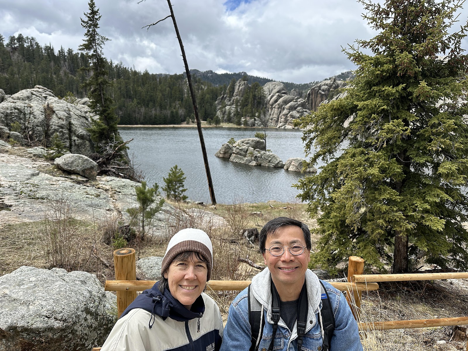
Despite the overcast skies, Sylvan Lake was very pretty. It's hard to tell from the photos, but several large rock formations jut out into the lake forming large boulder-peninsulas.
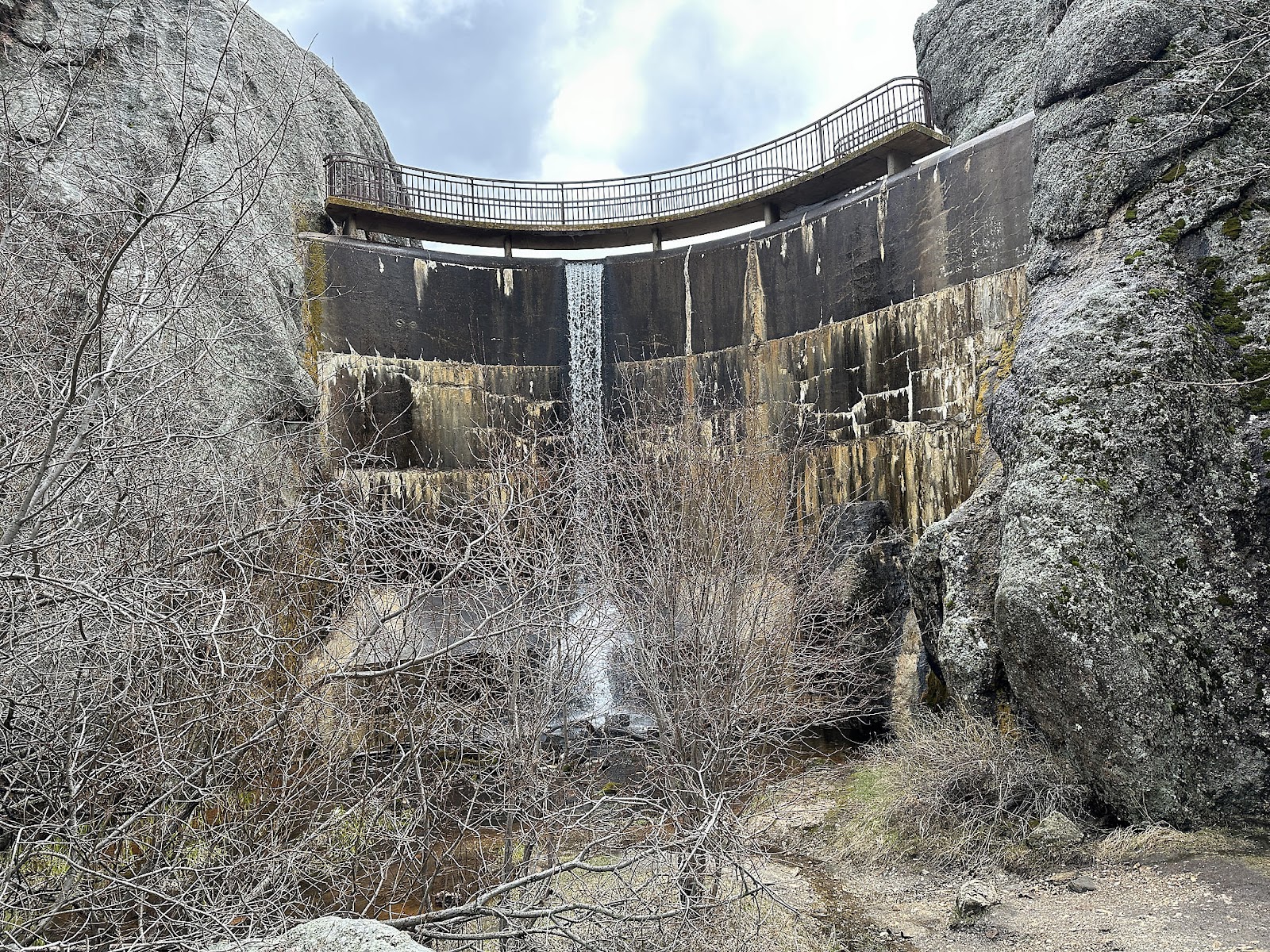
None of the lakes in Custer State Park are natural; all were formed by artificially damming a waterway. At the far end of the lake, a small natural "waterfall" occurred between two large rocks when the lake was formed.
And not too far away was a much larger artificial waterfall, from the dam's spillway.
There were still a few patches of snow on the ground - evidence that the Sylvan Lake area gets much colder than down in the valley where we were staying.
On top of the bluffs above us were some seemingly precariously balanced boulders.
While eating lunch in the parking lot we toyed with the idea of trying to do the Cathedral Spires hike on the way back down, but alternating spats of hail and sleet during our meal quickly changed our minds and we decided to just head back down into the valley instead - going through the Needles Eye Tunnel again so that Christine could be
inside the van this time (she didn't want to drive, though 😉).
The rain subsided again by the time we reached the valley, so we stopped by Legion Lake to do the 1 mile lake loop hike there. The park guide estimates it'll take 1 hour to do the loop trail, but based on the amount of time it had taken us to do the Lover's Leap Trail a couple of days earlier compared to their estimates (even with all our stopping for photos) and the fact that Legion Lake is . . . nothing particularly noteworthy scenery-wise, we guessed we could do the loop in 20 minutes. We finished it in 16.
All the mountain driving was burning up fuel and we had a lot more planned, so we stopped by the camp store to see how much gas cost there. It was unclear by looking at their single 1970's-era gas pump out front, but when we inquired inside they told us it was $4.99/gal. Not being desperate enough to pay California gas prices in South Dakota, we decided to drive into Custer the next day instead.
-----
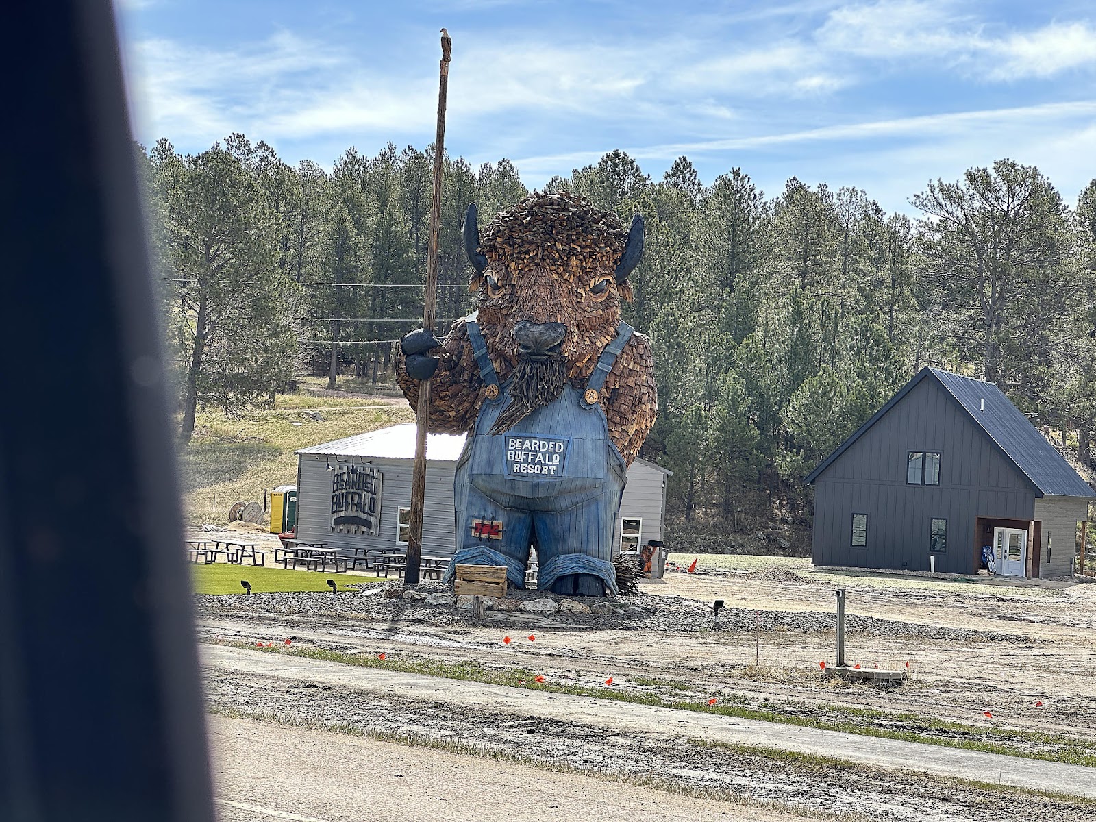
Friday, we returned to Sylvan Lake by way of Custer - both to get gas (paying a much more reasonable $3.44/gal, thank you very much) and shop for groceries. Around town there were a couple of amusing bison-related sights.
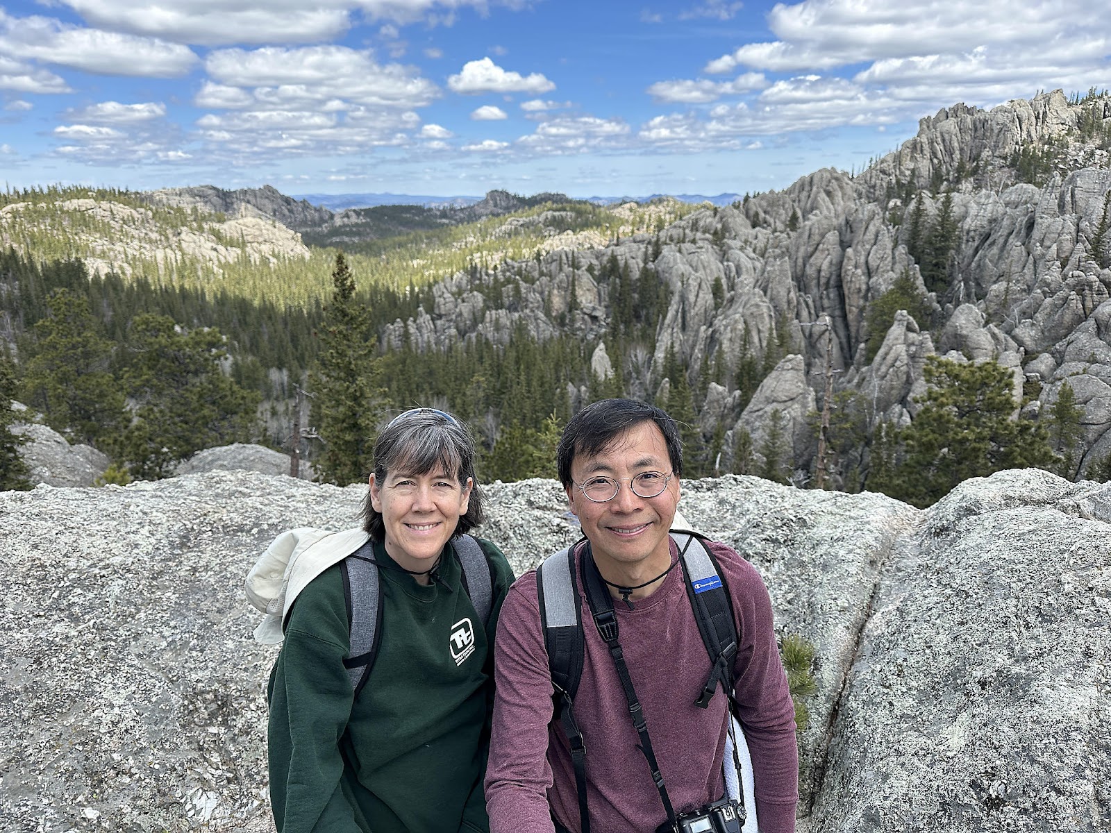
Our reason for returning to Sylvan Lake is that it is also the trailhead for the Black Elk Peak Trail. The signs near the trailhead indicated that the Peak is 1,097 feet higher than the lake, and the highest peak east of the Rockies at 7,242 feet. Like our trail guide, the signs were a bit vague on the distance only saying that it's "around 7 miles round trip" - probably because there are two possible trails that lead to/from the peak. We decided to take Trail #9 (lovely name) on the way up; this rock above the start of the trail reminded us of the "Grizzly Peak" at Disney's California Adventure (theme park).
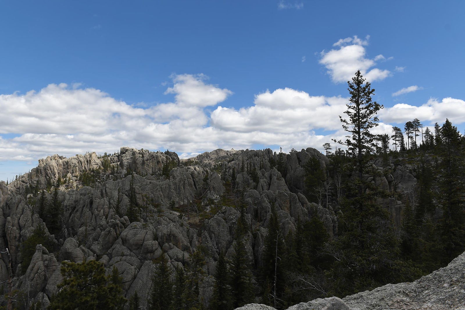
The trail was incredibly pretty as it wound its way through the forest, and it was very easy to forget where you were and imagine that you were hiking some high sierra trail instead. The unique rock formations were the main reminder of where exactly you really were.
From this viewpoint, we got our first glimpse of our eventual destination in the far, far, distance.
As we climbed, we encountered more patches of snow in various spots.
The first half of the trail lies within Custer State Park, but the back half of the trail is outside it in the Black Hills National Forest.
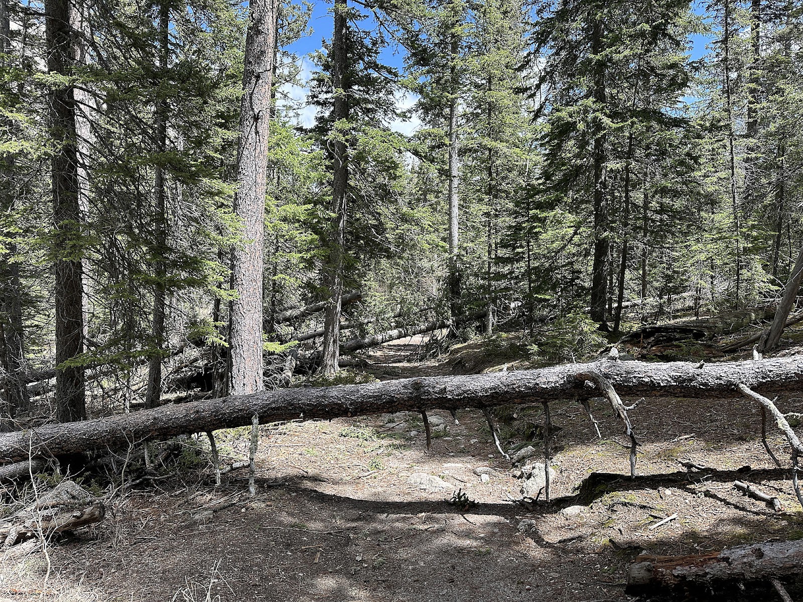
The National Forest portion had significantly more downed trees lying across the trail than the State Park portion. Some had a lot of fresh green foliage on it, and possibly had just come down in the previous night's storm. Others were quite dried out, and looked like they had been there for quite some time. Figuring out whether to go under, over, around, or in some cases
through the downed tree became an interesting game.
After abut two hours, we were finally in the "home stretch" and could see the tower again.
The Peak provided a 360 degree view into four states (although the tower itself sort of blocked a corner of the view, so you had to do the view in pieces "looking around" that corner).
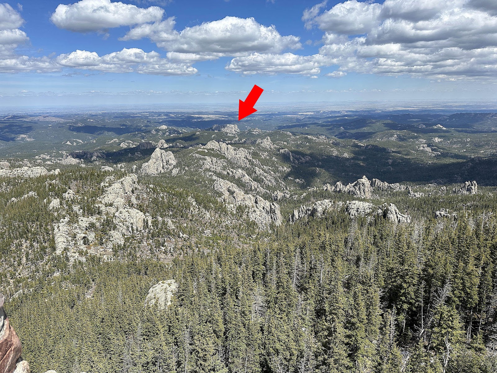
The Peak had a decided lack of signage, however, so it was hard to figure out exactly what you were looking at. We had read that you were supposed to be able to see the backside of Mt. Rushmore from the tower, and it was only through some creative use of Google Maps that we were able to locate it off in the distance.
The Visitor Center parking lot, with its copious solar panels, was actually the easier thing to spot first (see the red arrow below). From there we were able to track to the left and
just make out the very back edge of Washington's face (the yellow arrow below).
Here's a 1:1 crop of our best shot of Washington's face.
We decided to take Trail #4 (another lovely name) on the way back down, for variety. For awhile it seemed like the decision might have been a mistake, since the scenery was relatively uninteresting compared to what we had seen on the way up on Trail #9. But as we neared the Cathedral Spires area, the views got a lot more interesting quickly.
When we hit the intersection with the Cathedral Spires Trail, we had a decision to make: take the trail to see the Spires now so we could avoid having to negotiate the dinky parking lot later - at the expense of taking a drop in elevation that we'd have to make back up to get back to Trail #4 again - or just continue onward. We decided to take the trail now, since the Spires were a lot closer to this end than the other.
In addition to the various chipmunk and deer we saw on our journey, we also finally spotted the elusive marmot that we had been looking for (and started to believe we weren't going to see at this park).
On the drive back to the valley (along the Needles Highway again) we made a point of looking for the Needles Eye formation, which we had missed on our previous trips up/down the highway. As it turns out, it's just outside the Sylvan Lake end of the Needles Eye Tunnel - although easier to see when coming the other way; we had just missed it the first time, in our excitement of having made it through the tunnel unscathed (and haste to get out of the way of the next car trying make the transit).
It was late by the time we got back down to the valley, and we thought that we deserved a treat having hiked over 5 hours (not counting the time spent taking pictures at the Peak itself) covering 8.35 miles and an Apple reported 1,870 feet of elevation gain. Tom had been wanting to try some bison again, so we decided to splurge on dinner at the State Game Lodge Restaurant. Tom had the Buffalo Fillet Mignon and Christine had the (vegetarian) Poke Bowl.
Then it was back to camp and bed, since we had a 3:50 a.m. wake up call planned for the next day's early morning activity. More on that in the next post.


Comments
Post a Comment