Our main reason for visiting North Dakota was to spend time in Theodore Roosevelt National Park, which is divided into three "units" - only two of which are easily accessible and commonly visited. We split our time between those two units, spending three nights in the South Unit and one in the North Unit.
To get there, though, we took a somewhat unusual road.
-----
We survived our night by Gascoyne Lake, and woke Monday morning to calmer winds and a still-deserted campground. After getting gas in Scranton, we drove 45 miles northeast to the main activity for the day: the Enchanted Highway.
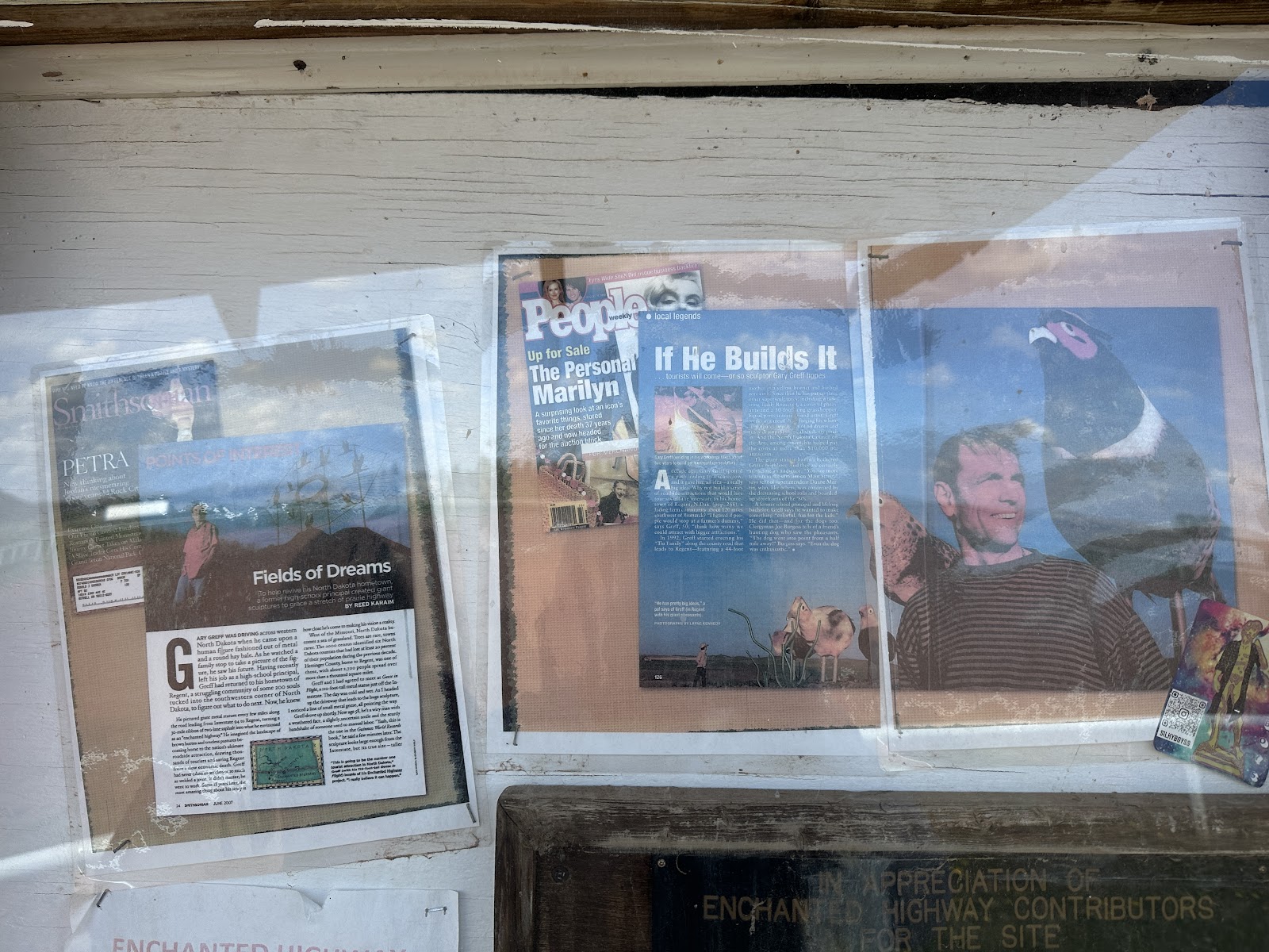
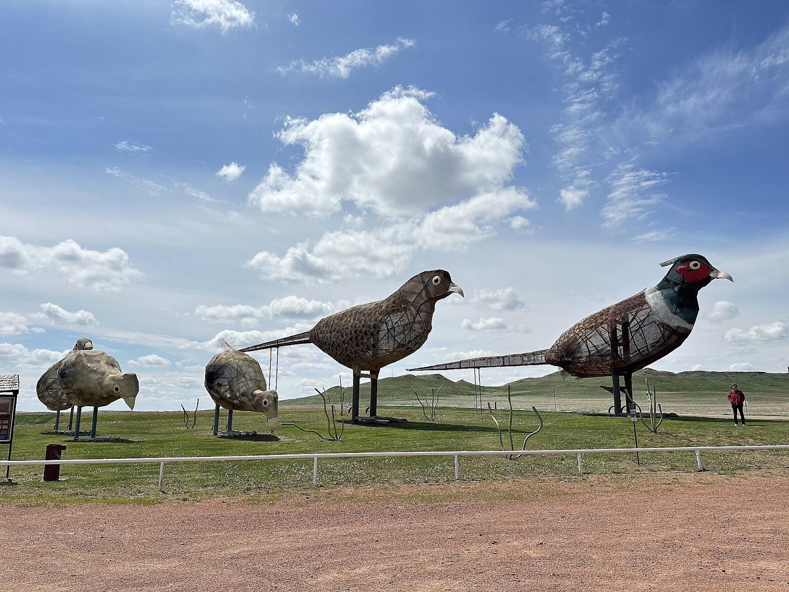
While we had read some descriptions of the Highway beforehand (which can loosely be summarized as "large metal sculptures by the side of the road"), we weren't quite prepared for the magnitude of what we were about to see - and photos probably don't quite do it justice either. This old magazine article (posted at one of the stops along the Highway) tells the backstory, but basically an ex-high school principal (with no prior art or welding background) was looking for ways to draw traffic from I-94 to his little home town of Regent, and came up with the idea of building these massive metal works of art along the highway between the two, and then did it (with the help of local farmers) - over the course of several decades.
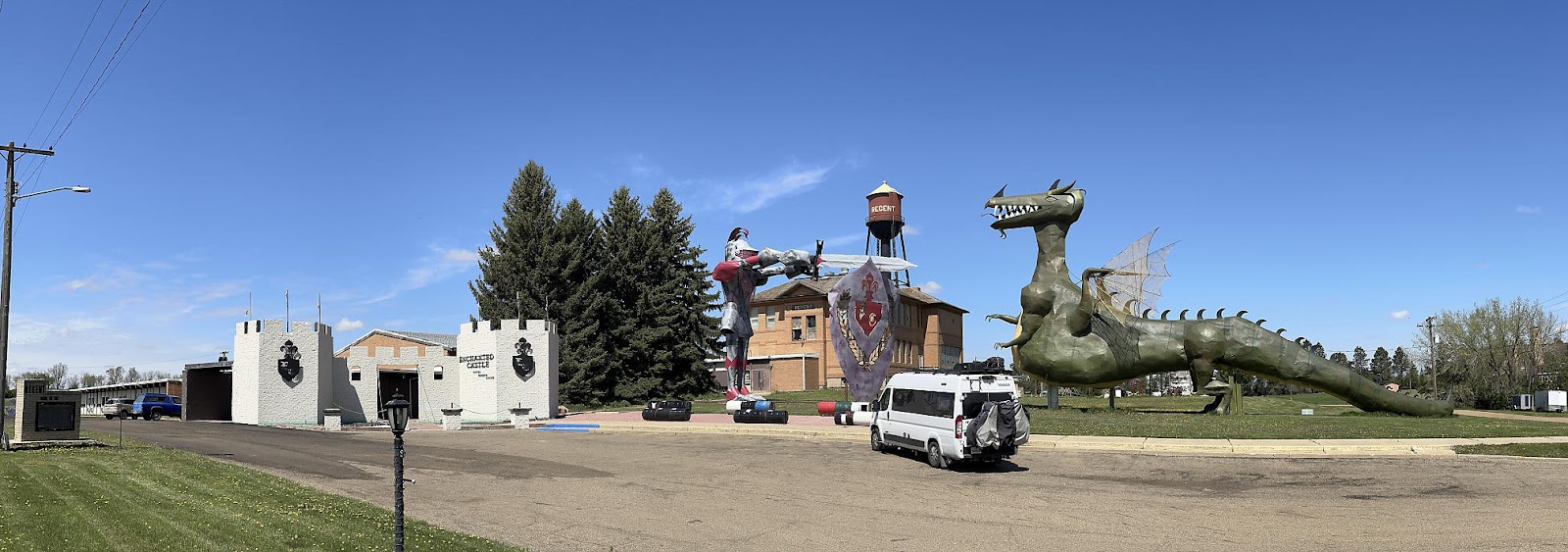
Our path actually had us driving the Enchanted Highway backwards, starting in Regent and working our way back to I-94, so our first stop was at the Enchanted Castle Hotel (a converted ex-high school) which is probably intended to be the last/best stop. Even though "Knight and Dragon" itself is still a "work in progress", it was massively impressive.
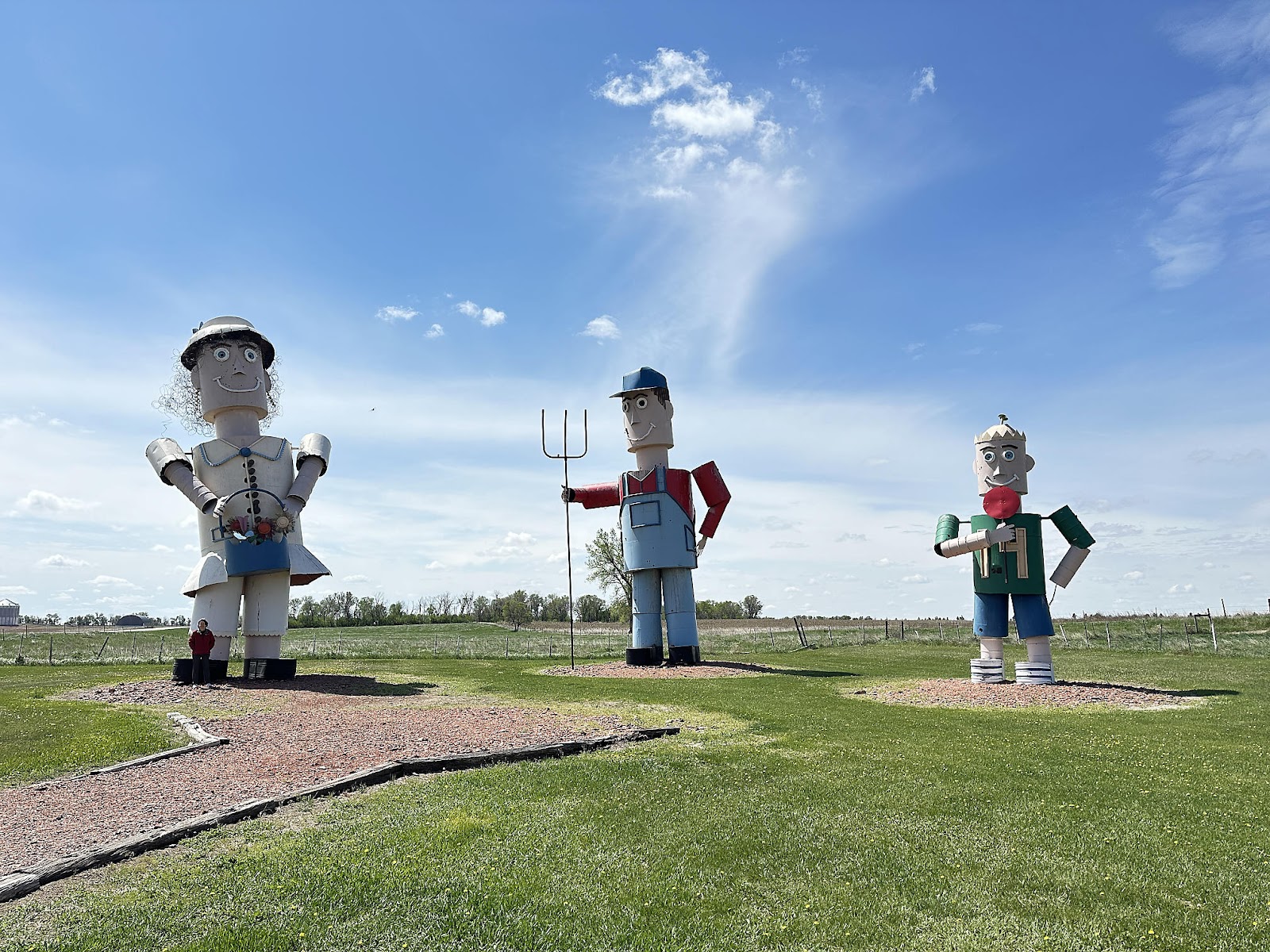
The next sculpture up the highway was "World's Largest Tin Family" - the first of the sculptures created. Ma is 44' tall, Pa is 45', and Junior is 23' tall.
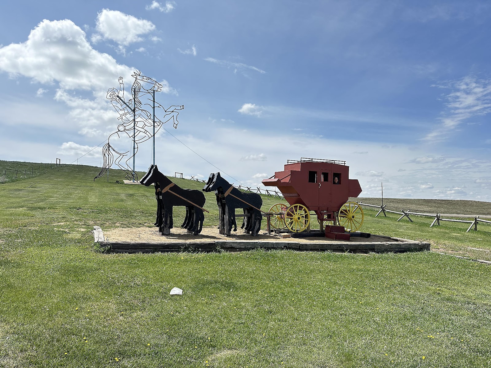
"Theodore Roosevelt Rides Again" is 51' tall. (The stagecoach was donated by a Regent resident.)
Tom's personal favorite was "Pheasants on the Prairie" (quite possibly because he had just seen his first real life pheasant running by the road earlier that morning).
Christine's favorite was "Fisherman's Dream", which is designed to move in the wind.
The largest bug in "Grasshoppers in the Field" is 50' tall.
At the "Deer Crossing" stop, there was the added bonus of "The Maze of Enchantment". We're happy to report that Christine made it through in record time, making only one wrong turn along the way.
"Geese in Flight", the first sculpture that most folks probably see, sits on a hill overlooking I-94 and you need to drive up a little road to get to it. The road itself is lined with small flying geese sculptures.
The main sculpture is 110' tall and 154' wide, and has the distinction of being listed in the Guinness Book of Word's Record as the world's largest scrap-metal sculpture.
Heading another 40 miles east brought us to our next destination: Theodore Roosevelt National Park. Somewhat unique to this national park is that one of its visitor centers sits right on the freeway and serves as a freeway rest area - so folks can actually see part of the park "for free". Our first glimpse of Theodore Roosevelt was from this Painted Canyon Visitor Center / Rest Area. The Visitor Center itself was closed by the time we arrived, so we just took in the views from the overlook. Tom's initial reaction: "this looks a lot like Badlands, but more densely packed and with more vegetation".
Our actual campground was actually another 30 minutes down the road. As we passed through the little town of Medora at the the entrance to the Park, we saw some modern-day cowboys riding along.
The Cottonwood Campground is part bookable and part FCFS (we had reservations), and was about half full when we arrived. They have water fill available, but no dump station (which we knew, so we used a free dump at a gas station on the way) so it was doubly inconvenient that half the bathrooms in the campground (including the one closest to our site) were closed since we had been planning to use those to stretch our black tank capacity until we made it to the North Unit. But such is life on the road.
-----
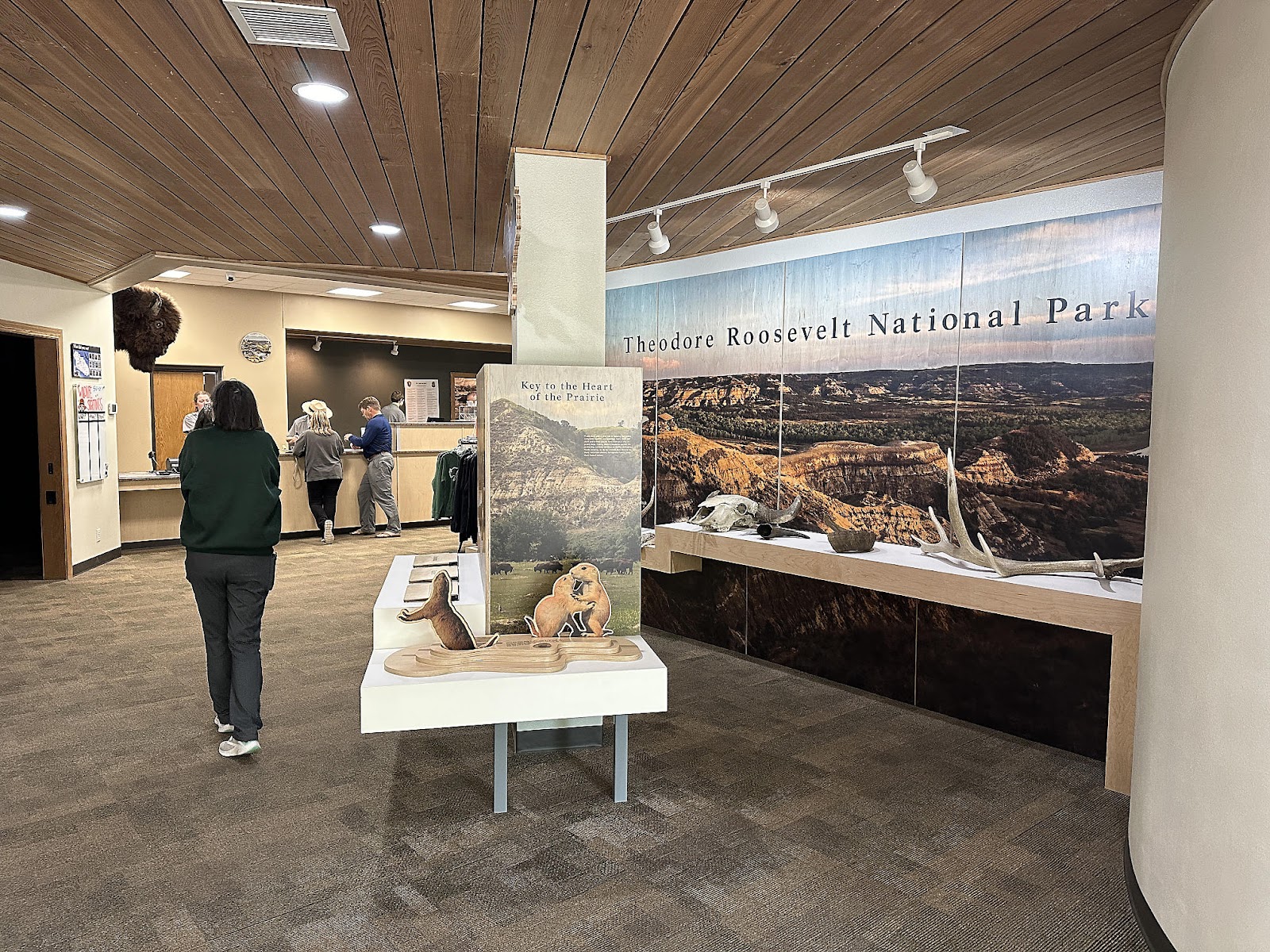
We started our Tuesday at the South Unit Visitor Center, where we browsed the museum and watched the park film. Both covered not only the history of the park, but the life of Theodore Roosevelt himself. It was interesting to hear how he transitioned from being a big game hunter (he originally came to the Dakota Territory to hunt one of the last remaining buffalo) to being one of the country's greatest conservationists.
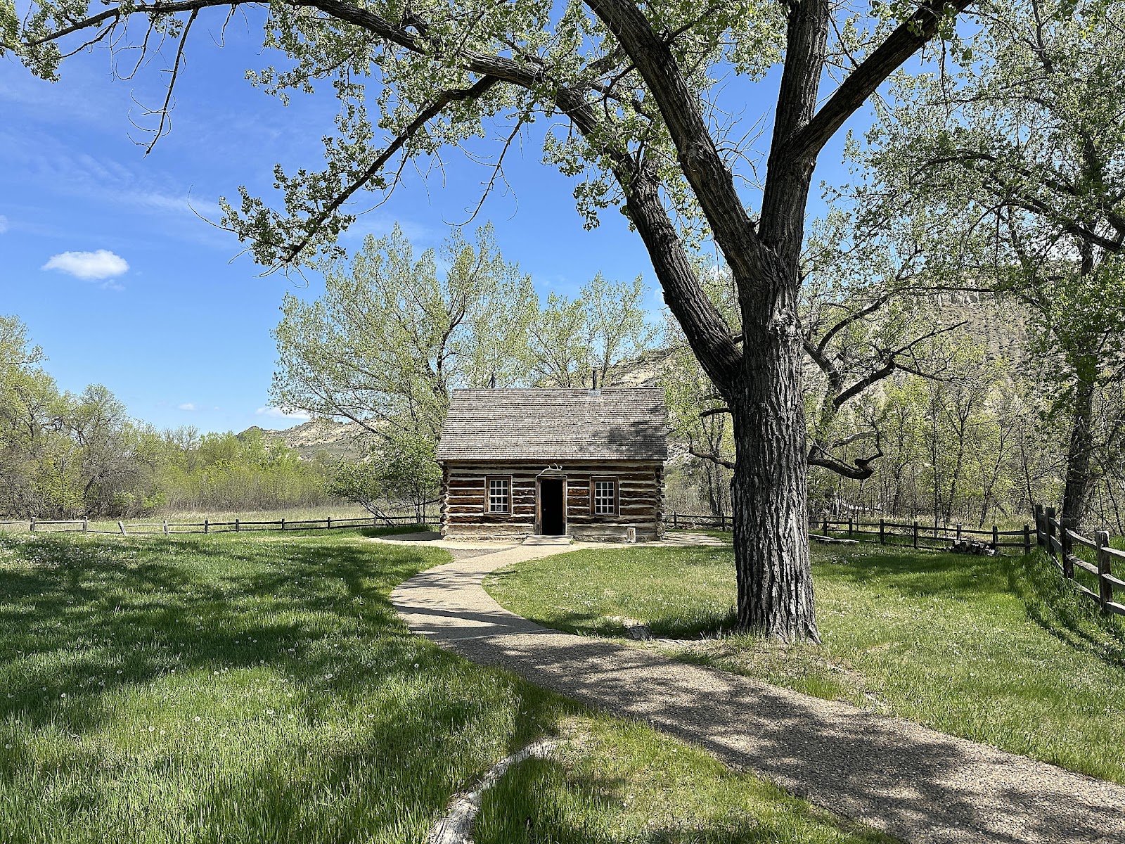
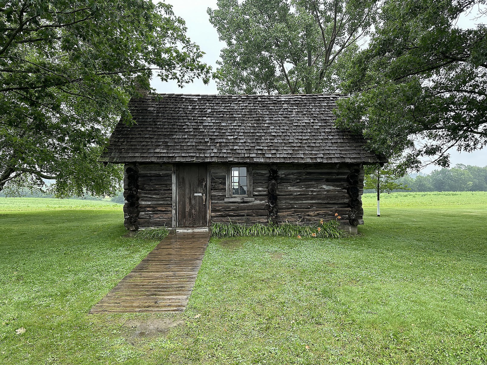
We also toured the Maltese Cross Cabin, which now sits behind the Visitor Center (7 miles away from its original location on the the Maltese Ranch). Almost as interesting as its historical significance is the fact that this cabin has been disassembled and reassembled/displayed all across the country, before finally making its way back here.
Our plan for the rest of the day was to explore the rest of the South Unit - or at least the parts that were open. There's normally a loop road throughout the Unit, but road construction has a portion of the loop closed off - although there was conflicting information about
where the road closures began. We decided to drive down the loop road as far as we could, and then work our way back from there. Along the way, we encountered a bison who clearly felt that that this was
his park, since he spent several minutes nonchalantly sauntering down the center of the roadway nicely holding up traffic.
The road closures started at the side road leading to the Coal Vein Nature Trail, so that was our first stop. The trail leads through an area that was impacted by a fire that burned in an underground coal vein for 26 years (from 1951-77). The first section you walk down to and through is an area which sank into the ground, after the the 12 foot coal vein underneath it burned away and the rock layer on top of it collapsed with nothing underneath it to support it.
This is where the fire finally burned out after 26 years. The guide book has this description: "Visitors could see smoke, glowing coals, and sometimes fames. They even roasted marshmallows over the fire!" My, how the times have changed; the fire has been out for almost 50 years, and
now NPS won't let you get anywhere near the site because "it's not safe". 🤣
This is the Hills Overlook. Since you are looking at the north-facing side of most of the hills here, which receive very little sunlight and are therefore able to retain moisture better, you see a lot of juniper growing. The south sides of the hills get a lot of sun light, are very dry, and are only able to support hardy grasses and drought-tolerant shrubs.
The trail eventually goes down a flight of stairs to a seasonal stream, where the air is slightly moister and cooler. The vegetation down there is much more lush than on the grassland above.
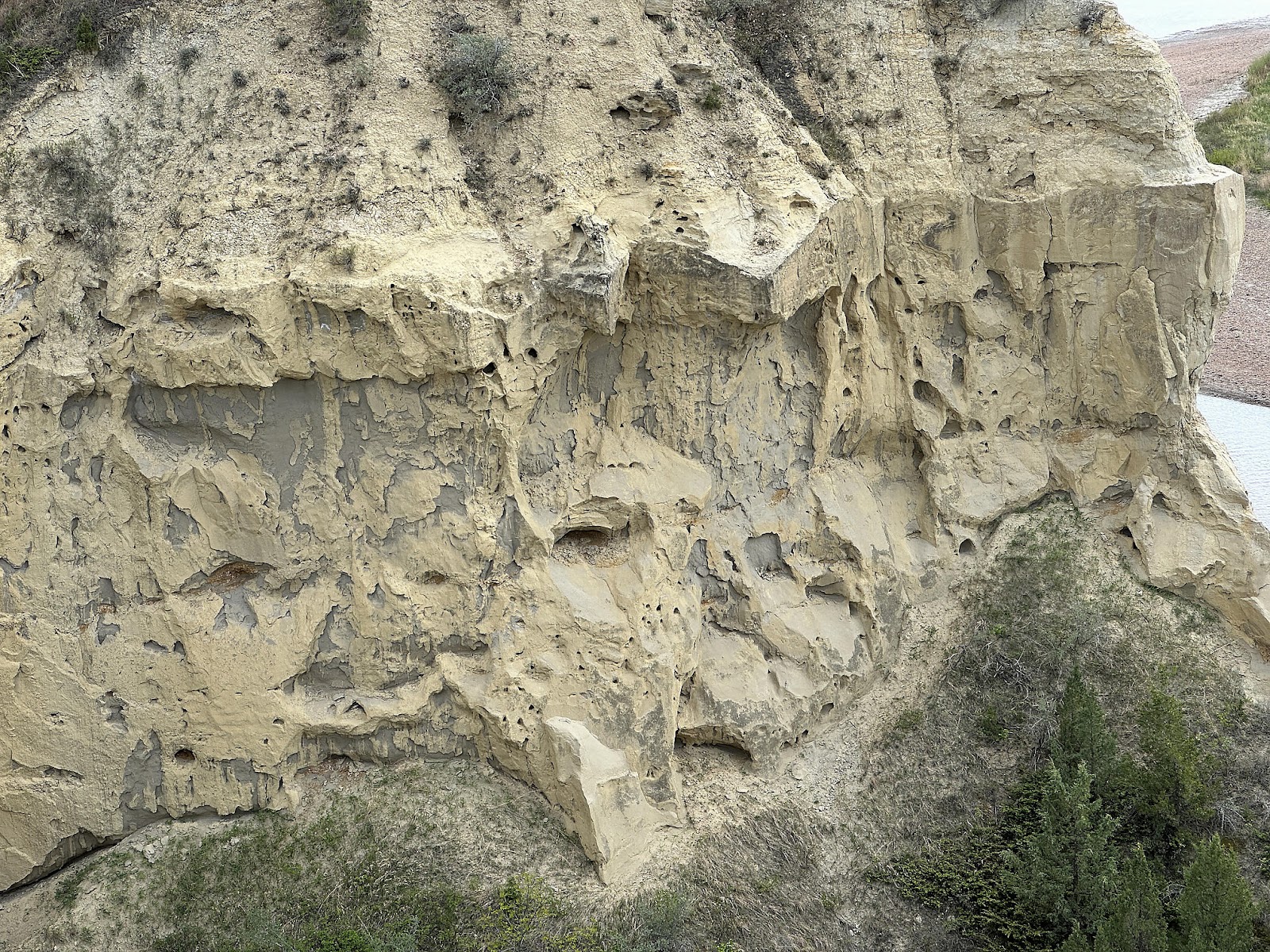
This is the Clinker Overlook. Clinker (the redish rock, near the center) is created when a burning coal seam bakes the rock layer above it, hardening it (similar to how clay is fired in a kiln to make pottery. It's one of the hardest rocks in the badlands, and functions as a caprock atop many buttes.
This particularly large piece of clinker is an example of a "chimney". As the coal fire burned deep into a hillside, cracks in the rock layers allowed air to be sucked down into the fire, which in turn burned up the cracks and baked the rocks nearby forming these vertical "chimneys". Chimneys are the hottest part of the coal fire, and bake the rock into a very hard clinker called porcellanite which is especially resistant to erosion. This chimney was exposed when softer sediments around it eroded away.
A lone bison watched us from up on a hill to make sure we made it back to the loop road okay.
Driving back along the road, there was another great example of the southern exposure = dry, northern exposure = moist phenomenon.
Our next stop was Buck Hill, one of the highest points in the park.
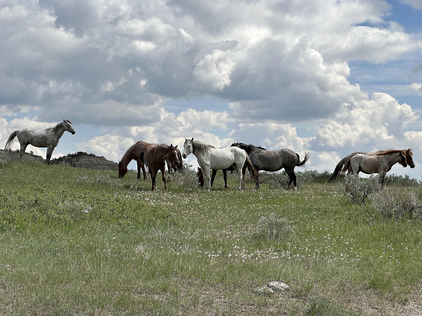
A little further down the road we came across a small herd of bison by the side of the road.
More random, interesting roadside scenery.
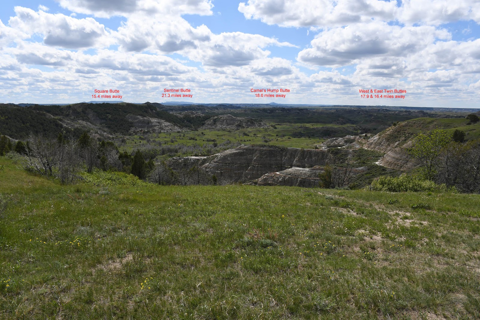
The Boicourt Trail was a short walk out to viewpoint from which, on a clear day like the day we were there, you could see a number of buttes on the horizon that were outside the park boundary.
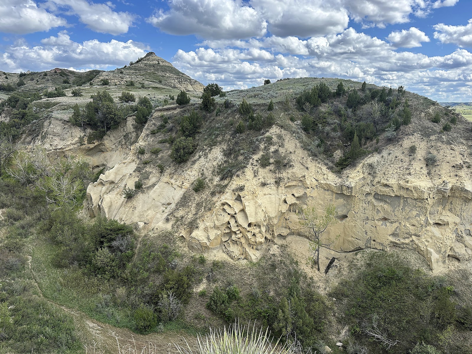
The Wind Canyon Trail stretches out along the edge of a high bluff overlooking the Little Missouri River, and provides a view of a large portion of the park. Wind Canyon itself is unique within the park in that its rock formations were carved by wind, not water, giving them a distinctly different appearance.
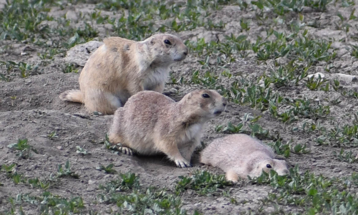
And since we had spied a prairie dog field from the viewpoint, we had to stop for a closer look on the way back.
Then it was back to camp. Tomorrow we'd be heading back to the Painted Canyon area to hike the trails there.


Comments
Post a Comment