Our activity for the Tuesday was a visit to the Gateway Arch National Park. Weather has not necessarily been our friend for our "scheduled" days on this trip; like the Eclipse Day in Lampasas, thunderstorms were forecast for our day in St. Louis.
Tuesday morning, we were back on the road at 8:30 headed westward from our night's stay over the border in Illinois. On an overpass over a creek we caught our first glimpse of the Gateway Arch in the distance, and realized (when seen next to the city's skyscrapers) how tall it really is.Crossing over the Mississippi River brought us back into Missouri. On the right of this photo you can see part of the Eads Bridge, St. Louis' "first" engineering marvel and the first bridge to be made of steel instead of iron.
Parking for our Arch visit was something of an adventure. The normally recommended parking garage only has a clearance of 6' 8", which is
way too short for the T42, so we had to find and use the "alternate" Riverside Parking instead. Reviews had warned that it was on a pretty sloped cobblestone levee, but we had no idea exactly how sloped it would be until we arrived. We weren't quite prepared for what it would feel like as the T42 pitched over to one side, almost feeling like it was going to tip over, as we drove off the access road onto the levee. Here's a photo of what she looked like (the bridge in the background is "level") when parked.
The parking spot
was very close to the Arch, though, and afforded us a photo op that never would've been possible from the parking garage.
One problem with being next to a structure as large as the Arch is that its very difficult to get it into a single photo. After a number of failed (or at least "wildly artistic") attempts, here's one that came out with an "acceptable" amount of distortion.
We walked along the North Pond Trail in the park to take some photos from a little further away. The cover photo was one, and here is another from the far end of the Pond.
The Old Courthouse, best known for the Dredd Scott case, as seen from the lawn in front of the Arch entrance. We didn't need to worry about whether we should be splitting our time between visiting the Arch and visiting the Courthouse, since the Courthouse was closed for renovations.
An Arch-clipse!
The entrance to the Arch (which is not at either of the feet, like you might think it is).
Inside the Visitor Center there was a mockup of the tram car you can ride to the top. We sat inside the 5-seater to get a feel for what it was going to be like; definitely not a lot of extra room in there!
After passing through security (which was vaguely amusing: the literature warns that "
all visitors to the Gateway Arch must pass through an airport-style security checkpoint", but when you ask the guard whether you need to remove your shoes his response is "no, we're not the airport") you walk down a couple flights of stairs to the underground museum. The main part of the Museum is divided into six themed halls.
We found this placard quite interesting, since we never knew why we refer to a dollar as a "buck".
In the Jefferson's Vision hall, we were reminded that between our visit to Fort Clatsop in Astoria, OR back in 2022 and our current visit to St. Louis we had now pretty much been to both ends of Lewis and Clark's Corp of Discovery Expedition trail.
Note the monitor on the wall in the photo below. There was one like that in every hall, listing all the timed activities and when you'd be able to enter them. More on that later.
We found this exhibit in the Building the Arch hall less than encouraging, and hoped that the actual tram cars were in a better state of repair than the model was. 😜
We found two things interesting about this display. 1) They were going to make the architect pay for his first ride up the Arch, even though he designed the thing. 2) They didn't refund his money, even though he died years before the Arch was actually completed. 😜
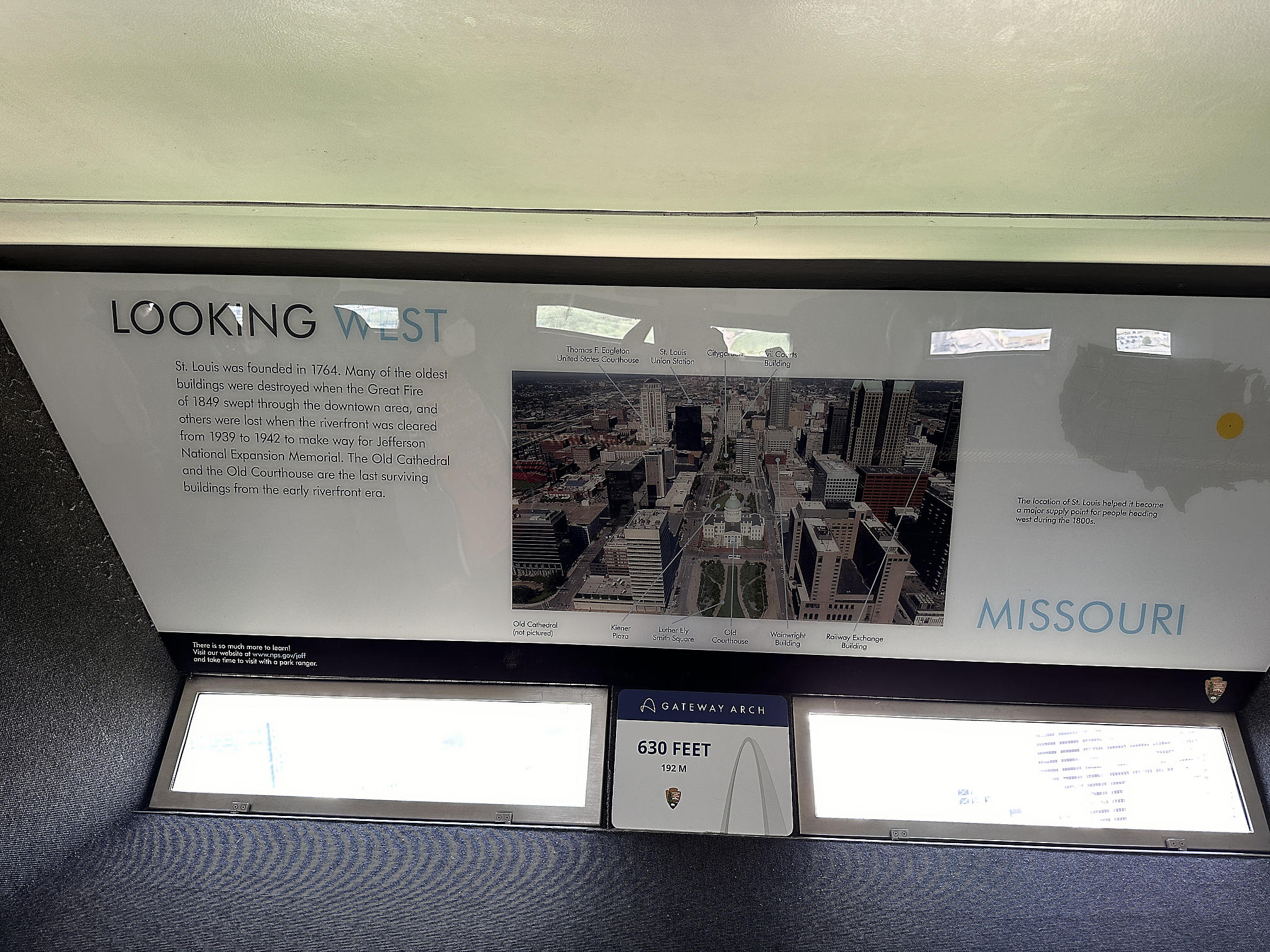
On the far side of the Museum was a lobby for the cafe, theater, gift shop, and trams. In the middle was a sort of mockup of the keystone section of the Arch. The inner dimensions may have been a fairly accurate representation of the inside of the actual Arch, but the monitors certainly weren't anywhere near the size of the actual windows!

Then it was "time" for our tram ride to the top of the Arch - sort of. We actually had pre-purchased tickets to ride the 12:00 North Tram up. Around 11 we checked one of the aforementioned scheduling monitors to see what time we should be going to the gate for that, and noticed that for the North Tram the display was reading "There is no tram scheduled for today." Err...what? We went to the ticket counter, and were re-directed to talk to the man at the gate. We asked the man at the gate who said "Oh yea, you can just come here when it's your ticket time." We noted that the listed times for the South Tram were all off by 5 minutes, and asked if we should come back for the 11:55 or the 12:05. "You can come for the 11:55" (turns around and looks at the line) "Or you can just go in now if you want to". We're guessing they weren't very busy that day. But since we hadn't actually been through the
Building the Arch hall yet at that point, we decided to see the exhibit first and come back at 11:55.
They say the tram experience takes 45-60 minutes total, but most of that is spent waiting in line, Disney-style. The first queue is in the corridor seen above. It gets filled with people for about 10 minutes, during which time the "tour guide" goes down the line distributing numbered boarding passes, to group people into sets of up to 5 (the capacity of a single tram car). We were in Lucky Tram #7.

We were then herded into the next holding area, where we were to gather on the dots on the floor corresponding to our boarding/tram number. We were joined by another couple from further back in line, who coincidentally were also "from California" (although they were originally from St. Louis). The "tour guide" gave some background information on the Arch and said some other things we couldn't understand (her headset microphone made her sound like the teacher from the Peanuts cartoons most of the time: "whah whah whah whah whah..."). A slide show was projected onto the concrete walls on either side of the room at some point as well.

Then it was down some stairs to the tram un/loading area, where you stood on your numbered circle in front of your numbered door waiting for your tram (filled with visitors coming back down from the top) to arrive. Given that the entrance to the Visitor Center was already below ground, and that the Museum/lobby was another two floors below that, we figure that the tram un/loading area must be pretty far underground.
We had about a minute after the doors opened for the previous occupants to vacate and for us to enter, find our seats (and hit our heads, because the curved ceiling prevents a full grown adult from being able to sit up straight in the seats), and get situated before the doors closed and we were our way. The doors have windows in them, partly to make the tram seem less claustrophobic, and partly to let you see the internals of the Arch on your way up/down. Here's a video taken through the window on the way up.
The tram un/loading area was decidedly smaller at the top than the bottom, and we had to squeeze by the folks queued up to go down to get to the observation area. The observation area itself was reminiscent of the Washington Monument in that there were small windows to look through: but the Arch was only two sided, and had a hump you had to walk over to get from one end to the other. The monitors below had also warned that "due to weather conditions a slight sway can be felt at the top of the Arch today" and they were not wrong; it was a little disconcerting, but there was a shelf to lean on while looking out the windows so it wasn't too bad.
We were relieved to see that a strong gust of wind hadn't rolled the T42 down the levee into the Mississippi yet.
Our "eight minutes at the top" was over relatively quickly, and we were called back into loading position in the narrow un/loading area to await the incoming tram for our trip back down.
We had been on the fence about whether to also see the
Monument to the Dream film, thinking that it might just be a re-hash of other displays in the museum, but on the recommendation of our tram-mates we bought tickets and watched it after we were done in the other museum halls. It was really well done, and well worth it - containing lots of archival footage of the construction of the Arch.
As we left the Visitor Center and walked out to see the Old Cathedral, the good luck we had been having with the weather all day finally gave out as it started to rain.
But we still had to stop for one last photo on the way back to the van. What are a few little raindrops?
We had a great time at our Day at the Arch - and also earned the first new sticker of the Trek for our Parks of the USA water bottle!
We left St. Louis in light rainy commute traffic that evening and headed to 50 minutes west to Chesterfield, the location of our Harvest Host for the evening: a church called Epic Empowerment. Not particularly picture-worthy, we literally stayed the night in an empty church parking lot.
-----
We were awoken at 7:30 Wednesday morning by two things: the wind buffeting the coach once again, and the sound of what we thought was persistent distant train. It turns out the train was really a bulldozer driving back and forth on the empty plot next door; time to get up and hit the road.
Apple Weather claimed that the winds were only 17 mph with occasional gusts to 35 mph, but they still made for some uncomfortable driving. Shortly after merging onto I-70 West we made an amazing discovery: a sign for a bona-fide Rest Area (the first we had seen since leaving New Mexico) - so they do exist in Missouri, as long as you're driving on the right road! Even though we had only been on the road for about 40 minutes at that point, we decided to check it out. It was we maintained and cute, with nice landscaping.

Unfortunately, the wind at the Rest Area must've blown some odd pollen into Tom's eyes because shortly down the road they became extremely itchy and watery. He wanted to stop somewhere and flush them out, but didn't want to risk getting off on some exit that wouldn't have a good shoulder to pull off onto and/or easy access to get back onto the interstate. And then we started seeing the billboards for Ozarkland - a glorious red barn paradise that promised a candy kitchen, clothing, gifts, souvenirs, and a multitude of other things (we were thinking "Missouri Nut Tree"). It was a sign. We had to stop.
Ozarkland
was as described, we guess. There were sections with toys, clothes, food, souvenirs, kitschy garden decorations, pet clothing/supplies, soaps/lotions, knives, etc. - of course, we left with nothing. Tom felt much better after getting a chance to wash his eyes out, though.
Our transit activity for the day was to bike a section of the Katy Trail State Park. The Park is interesting, being 240 miles long and "built" on the former corridor of the Missouri-Kansas-Texas Railroad. There are numerous trailheads along the park: we chose the one at the old McBaine Station, as it is reportedly one of the most scenic portions of the trail. The plan was to bike (yes, we finally got to use the bikes that we've been hauling around for the past 3000 miles!) the 7 miles out to the far edge of the Eagle Bluffs Conservation Area (and then back again).
The trail was hardpacked gravel that traveled net-level (but gently up and down) through mostly tree covered areas, with the Missouri River weaving in and out of view. We were a little apprehensive that the wind might make biking difficult, but the trees and bluff seemed to provide the necessary wind break - on the trip out, at least.
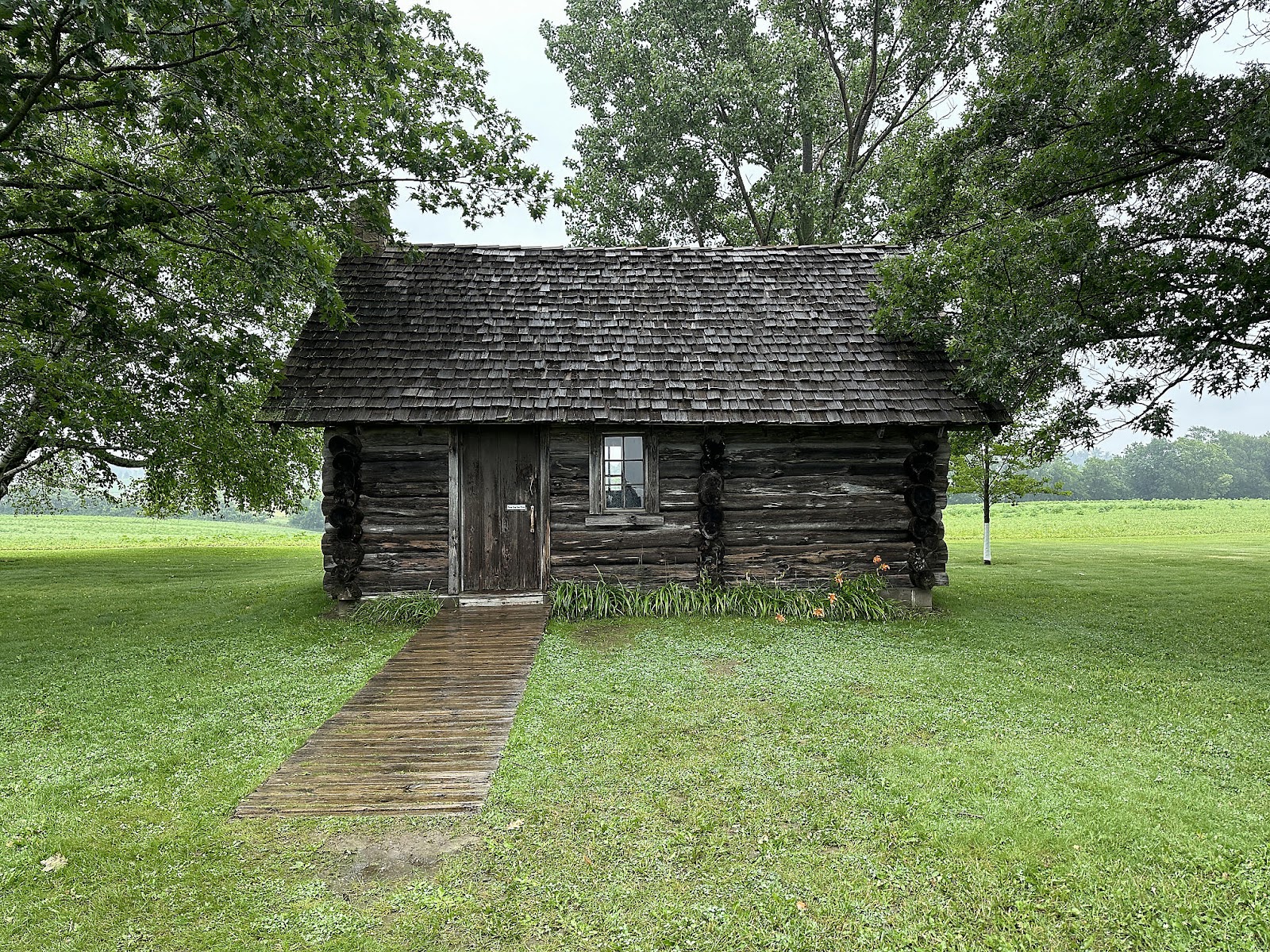
About 2.5 miles down the road we encountered a historical marker indicating that our trail intersected a section of Lewis and Clark's Corps of Discovery Expedition trail.
It took us a little while to actually locate the arch they were describing, due partly to all the trees. We finally found it, visible in the upper-left hand corner of this photo.
Walking around and looking from different places, you can
just see sky visible through the arch's hole if you look at
just the right angle.
Eagle Bluffs themselves proved to not be particularly picture-worthy (relatively short rock walls, obscured by trees). Over certain parts of the path, large birds could occasionally be seen circling over the path. The tree cover made it difficult to photograph them, since they'd be visible for only a second or two before disappearing behind the tree cover again, but here's one (we're 99.9% sure that it's just a Turkey Vulture, though):
Near the end of the bluffs we crossed an old railway trestle.
The wind picked up a bit by the time we turned around, and we ended up having to bike against a mild headwind the entire return trip. Despite that - and not getting to see any actual eagles - it was a pretty ride and it felt good to get out on the bikes at last.
Driving down we had seen signs on the freeway for China Garden Buffet. After our 14 mile bike ride we felt that we had earned a little treat, so we headed over there to see what a Missouri Chinese buffet would be like (a Yelp pre-check showed 4 stars). Although the exterior was nondescript, the interior was nicely decorated - including a nice fountain with real koi in its pool:
The only bit of Missouri-flavor-oddity in the decor was perhaps the mounted animal heads on the walls, and a frosted glass picture depicting a Native American village where you'd normally expect to see an Asian one.
The food was not bad, though: most of the typical Chinese buffet "hot dishes", plus a hibachi station, and a small (but better than typical buffet quality) selection of sushi. About 4 plates in, Christine asked: "shouldn't we have taken a photo?" So here's one, from near the end of the meal.
Very unlike a California Chinese Buffet: we showed up 30 minutes before the lunch -> dinner transition (and stayed over an hour into the dinner buffet time zone), and they still only charged us the lunch buffet prices. 😀
After stuffing ourselves silly, we finally arrived at our next destination a little after 6:30 pm: Lake of the Ozarks State Park.
The campground is huge, with 182 sites across 4 sections. Our site (104) was in the bottom-most section, at lake level.
On the way back from the shower house that evening, we were greeted by the welcoming party: a herd of deer on their way through the campground.


Comments
Post a Comment